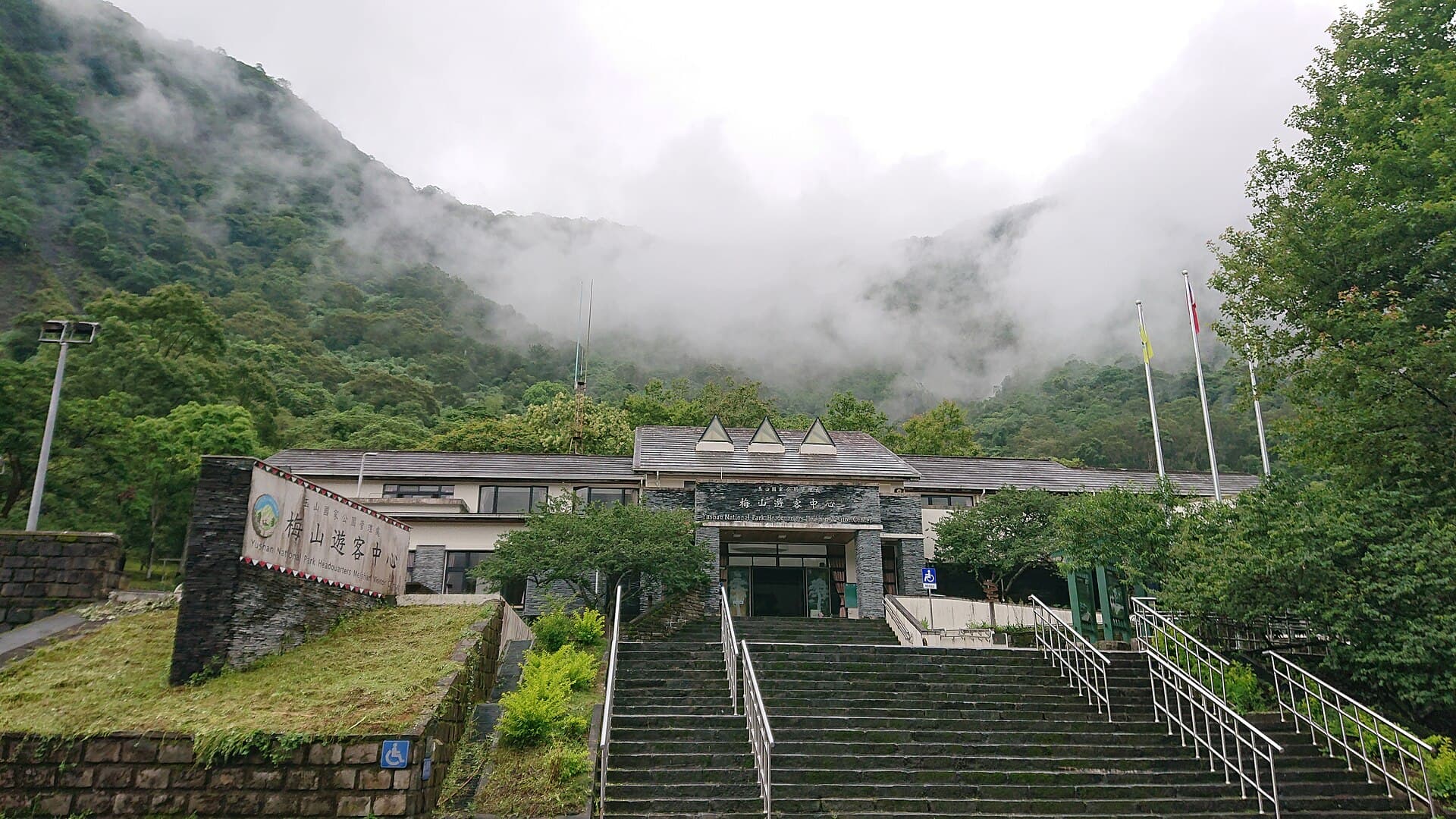
Yushan National Park - Meishan Visitor Center
Yushan National Park is located in the central region of Taiwan. It was established on April 10, 1985 (Year 74 of the Republic of China), becoming Taiwan's second national park. The park features towering peaks and steep…
Visitor Essentials
Yushan National Park is located in the central region of Taiwan. It was established on April 10, 1985 (Year 74 of the Republic of China), becoming Taiwan's second national park. The park features towering peaks and steep ridges, with thirty of Taiwan's "Hundred Peaks" (mountains over 3,000 meters) situated within its boundaries. Some mountains are majestic and magnificent, while others boast unique and exquisite beauty, making it a breathtaking and quintessential mountainous national park. The entire park is centered around Yushan Main Peak, extending to parts of the southern Central Mountain Range. Its vast area spans four counties/cities: Nantou, Chiayi, Kaohsiung, and Hualien. It stretches from Malijianan Mountain in the east to Guanshan in the south, Nanshi Forest Road in the west, and Jundashan in the north, covering an area of 105,490 hectares, making it the largest national park in Taiwan. It also encompasses the headwaters of major river systems in Taiwan's central, southern, and eastern regions, which are vital to the livelihoods of downstream communities. Due to the park's elevation ranging from Yushan Main Peak at 3,952 meters down to the bottom of the Lakulaku River at 300 meters, temperatures decrease with increasing altitude, resulting in two distinct climate types: temperate and frigid. In addition to its rich flora, the park also harbors abundant wildlife and scenic natural resources. The park's rich and precious natural and cultural resources are shared by all. This environment's most crucial role is to provide a place for people to connect with nature, serving as a sanctuary for spiritual rest and rejuvenation, and a pristine paradise for future generations. Due to its vast area, the park is divided into four main zones: * The Northwest Zone is located on the northwestern side of Yushan National Park, encompassing areas such as the New Central Cross-Island Highway, Tataka, Dongpu, Guanguo, Batongguan, Yushan Main Peak, and Nanshi Forest Road. * The Southern Zone is located on the southwestern side of Yushan National Park, including areas along the Southern Cross-Island Highway, Meishan—Tianchi—Zhongzhiguan—Yiakou, the Three Southern Cross-Island Mountains, and Guanshan. * The Eastern Zone is located on the southeastern side of Yushan National Park, including areas such as Nanan, Shanfeng, Walami, Dafun, and Xinkangshan. * The Alpine Core Zone is located in the northeastern and central parts of Yushan National Park, including areas such as Dashuiku, Xiuguluan Mountain, Mabolas Mountain, Tafen Mountain, and Mashishan. Four visitor centers are separately established at the Yushan National Park Headquarters, the New Central Cross-Island Highway - Tataka Recreation Area, the Southern Cross-Island Highway - Meishan Recreation Area, and the Walami - Nanan Recreation Area, providing services such as multimedia viewing, consultations, and interpretive guidance. Tianchi (Heaven Lake) is located at the junction of the eastern and western sections of the Southern Cross-Island Highway in Kaohsiung City, approximately at kilometer 135 of Provincial Highway 20. The Changqing Shrine was built to commemorate the veterans and engineers who died while constructing the highway. It offers excellent views of Yushan South Peak and the southern section of the Central Mountain Range. A walk of about 10 minutes along the path to the left of Changqing Shrine leads to Tianchi (Heaven Lake), located at an elevation of approximately 2,200 meters. The lake's edge is lush with greenery, and its waters never dry up throughout the year. Looking down from the bamboo grass slopes, it resembles a clear mirror reflecting the emerald mountain forest scenery. It is a highly renowned alpine lake in the southern region. Hinoki Valley (Kui Valley) is located in Kaohsiung City, approximately at kilometer 141 of Provincial Highway 20, about 6 kilometers from Tianchi and Changqing Shrine. Here, a cluster of colossal hinoki cypress trees stands before you, marking "Hinoki Valley," the most extensive primitive forest landscape along the Southern Cross-Island Highway. With an elevation of about 2,454 meters, the forest is often shrouded in mist, adding a serene and poetic charm. The Daguanshan Tunnel (Guanshan, Yiakou) cuts through the main ridge of the Central Mountain Range, extending over 600 meters in length and situated at an elevation of more than 2,700 meters. It is the highest point on the Southern Cross-Island Highway and marks the boundary between Kaohsiung and Taitung counties, located approximately at kilometer 147 of Provincial Highway 20. The sea of clouds at Guanshan has long been famous. Yiakou Mountain Villa, located east of the tunnel, offers the best vantage point for viewing the majestic Guanshan Great Cliff.
Discover the Context
No stories linked yet.
Happening at Yushan National Park - Meishan Visitor Center
View CalendarNo upcoming events at this venue.