Datun Mountain Range_Junjianyan Hiking Trail
Junjianyan (Battleship Rock) is located in the mountainous area directly north of Taipei Veterans General Hospital in Shipai. It has an elevation of 185.6 meters. The hiking path is about 3 kilometers long, with the enti…
Visitor Essentials
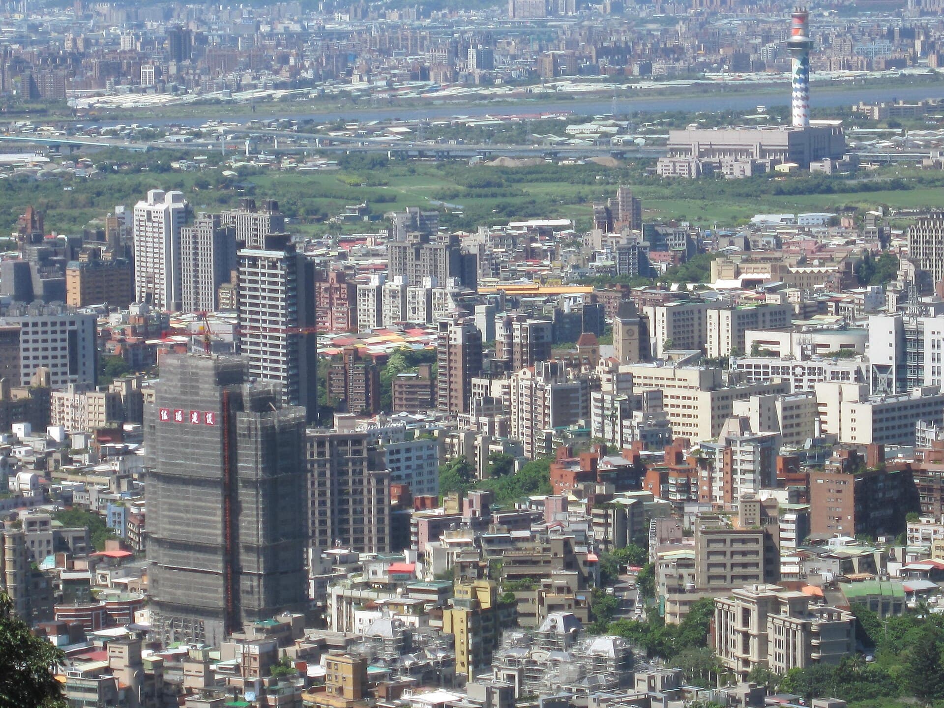
Junjianyan (Battleship Rock) is located in the mountainous area directly north of Taipei Veterans General Hospital in Shipai. It has an elevation of 185.6 meters. The hiking path is about 3 kilometers long, with the entire route being approximately 5.7 kilometers and taking about 2 hours and 7 minutes to walk. It is a famous peak within the Datun Mountain Range. The prominent giant rock on the ridge stands tall amidst layers of mountains, resembling a battleship at sea at first glance, hence its name, Junjianyan. During the Japanese colonial era, it was collectively known as Wujianlianfeng (Wujianlian Peaks) along with Cili'an Mountain, Danfeng Mountain, and Wujianlian Mountain. The rock climbing area at the summit is an ideal spot for climbing practice, and it's also a very popular hiking route. **Junjianyan Nature Trail** Walking along the Junjianyan Nature Trail, one can enjoy precious old trees and natural landscapes. The view from the summit is expansive, and Academia Sinica has established a crustal deformation benchmark there for recording and research purposes. Looking right from the summit, one can admire the ridge and scenery stretching from Shilin to Beitou; looking left, one can overlook the quiet and peaceful modern community of Wellington Villa, offering broad and beautiful vistas. **Danfeng Mountain** Danfeng Mountain, with an elevation of 210 meters, has a relatively flat terrain and a very serene environment, similar in natural setting to Junjianyan. Its sandstone topography results in a thin soil layer and low water retention, leading to a drier environment and thus a higher risk of wildfires. **Wujianlian Mountain** Wujianlian Mountain, with an elevation of 282 meters, was connected with Cili'an Mountain, Danfeng Mountain, and Junjianyan during the Japanese colonial era, collectively forming the Wujianlianfeng (Wujianlian Peaks). The summit of Wujianlian Mountain has a wooden marker and a triangulation stone (No. 2363), offering panoramic views of Junjianyan, Cili'an Mountain, and the Beitou and Shilin areas. From Wujianlian Mountain, one can proceed to Huangxi Mountain, or descend via Quanyuan Road to reach Fenghuanggu Recreation Area. **Ambling Up the Rock** Junjianyan has long been a popular holiday destination; the path is not long and is easy to climb. The nearby Danfeng Rock, with its striking red characters "丹鳳" (Danfeng) carved on the cliff face, is very eye-catching when viewed from Beitou towards the mountain, inevitably inviting closer inspection. The hike to Junjianyan is not long, and the coexistence of stone steps (man-made) and natural sandstone (native) offers a unique charm along the way. Hard, rugged rock formations stand firmly on both sides, as if supporting the path like bedrock, making the journey comfortable and secure. A newly built scenic pavilion along the way, perhaps designed to echo the grandeur of the surrounding rocks, appears particularly spacious. Pausing here, and contrasting with the bustling urban landscape of Beitou at the foot of the mountain, the Wellington Villa built along the hillside to the left appears exceptionally serene, with its white walls and red tiles standing out against the mountain backdrop. Continuing up the steps past the pavilion, the view gradually opens up. Junjianyan is not far away; looking back at the path taken, expansive views unfold, revealing the Guandu Plain wetlands and the winding Keelung River flowing into the Tamsui River. Still yearning for more, Junjianyan stands before you, with Huagang on Yangmingshan and Chinese Culture University nestled in the mountains serving as a natural backdrop. **The Joy of Riding the Wind** Eagerly ascend Junjianyan to fully enjoy the feeling of the wind and appreciate the surrounding beauty. The 360-degree panoramic view encompasses the Taipei Basin and its surrounding mountains. Beyond the nearby urban landscapes of Shilin, Beitou, Shipai, and Tianmu, one can gaze upon the stunning mountain scenery of Guandu Plain, Guanyin Mountain, the Datun Mountain peaks, Shamao Mountain, and Wuzhi Mountain – truly magnificent. Standing atop the rock, it truly feels like being on the "Titanic of the Mountains" – powerful gusts of wind sweep across, offering an endless, boundless vista in every direction. After fully enjoying the summit, descend to the large rock face nearby. Looking around, the smooth, pristine white rock surface feels like a clean and refreshing coastline, making one want to take off their shoes and walk barefoot on the polished giant rock. Up close, Junjianyan bears a striking resemblance to the weathered sandstone along the Northeast Coast. This association is not fanciful, as this area was originally a coastal region. If you doubt it, the ubiquitous snow-white sandstone is the best proof. The geology of Junjianyan originates from the Mushan Formation, deposited over 20 million years ago. After long-term erosion and deposition by seawater, it became snow-white sand particles. Over time, combined with cementation, it formed thick layers of hard sandstone, finally uplifting through orogenic movements. **Natural Wilderness Charm** Junjianyan, with an elevation of less than 200 meters, not only features ubiquitous low-altitude indicator plants like ferns, but also hosts some plants typically found at mid-to-high altitudes. This is because it is located at the entry point of the northeast monsoon, and the ridgeline experiences strong wind pressure and lower temperatures, causing a significant descent in the plant ecological zone. Along the ridgeline, one can observe common coastal plants such as Myrtle and Dodonaea. Danfeng Mountain is not as steep as Junjianyan, but its natural environment is similar. Plants common at Junjianyan, such as Dicranopteris, Dodonaea, and Breynia, are also found here, and in a more expansive area. However, perhaps due to past wildfires, most of the trail is cordoned off with ropes on both sides, marked as "conservation zones" where entry is prohibited. Similar to Junjianyan, the sandstone topography leads to a thin soil layer and poor water retention, making the environment drier and increasing the risk of fires. Additionally, the oil-rich pine trees are highly flammable, further elevating the fire hazard index here. Ryukyu Pines are the dominant species on Danfeng Mountain; solitary pines or small clusters can often be seen on the open ridges and hillsides. Walking on the gentle trail, one can sometimes catch the subtle fragrance of pine. Towards the end of the trail, three pavilions appear in close succession along the path; some are even positioned directly in the middle of the route, creating a sense of "the guest overshadowing the host." With varied designs – flat-topped mushroom-shaped or traditional garden style – hikers can choose their preference, adding a touch of fun before the journey concludes.
Discover the Context
No stories linked yet.
Happening at Datun Mountain Range_Junjianyan Hiking Trail
View CalendarNo upcoming events at this venue.